


Google Maps has been quite controversial because time and again, it has thrown people some weird locations that nobody spotted before. Some of them have been explained to be a glitch, but there are certain places that have gone down as the creepiest locations. Check them out below.
Giant Disfigured Bunny:
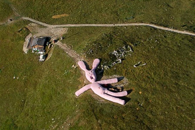
Just like the bizarre location of Hollywood horror movies, this place makes anxiety out of yours. Located in the northern section of Italy, this almost barren-land has a gigantic disfigured bunny soft toy to evoke the loneliness and fretfulness of the spot. Through Google Maps, you can observe the face of the toy in the gesture of a screaming. Basically, it was an installation art done by the Viennese collective to grasp the attention of the roamers.
Nogoro, Japan:
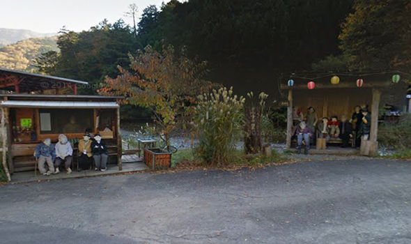
After watching “Grudge, if you want to get horrified, then you must explore Nogoro village on Google map. It is a countryside situated in Japan, where you can come across several people here and there oven the town. Once you zoom into the scenario, you will definitely unveil the real creepiness; those random people all over the village are not humans! They are actually lifeless dolls created by a village-dweller Ayano Tsukimi in remembrance of the dead. This factor makes Nogoro creepier.
Underwater Pyramid:
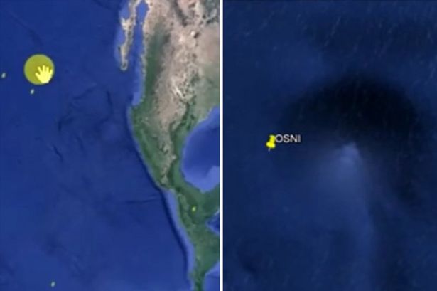
Discovered by a conspiracy theorist, these underwater pyramids are considered to be proof that aliens have their footprints on the earth. The Google map finds these pyramids under the sea of Bahamas. It is a belief that mystifying pyramids were built during the ancient civilization.
Abandoned Gas Masks:
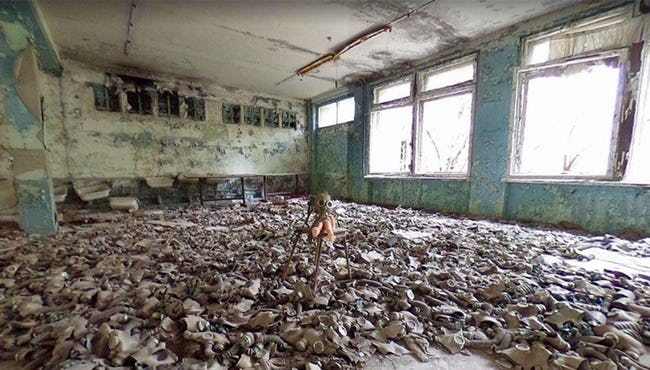
Infamous for most awful nuclear disaster, the Google map traces a deserted town in Ukraine namely Pripyat. This abandoned town has rows of empty buildings. Pripyat witnesses a creepy sight where a room is filled with discarded gas masks. The Google map is successful in capturing the hollowness and lost inhabitation in the form of silent monochrome. The awkwardness relies on the child-sized masks that are found in an abandoned school.
Murder Victim:
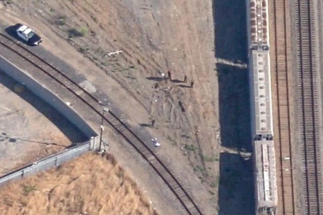
One of the most shocking and creepy things that Google map captures, is the dead body of a 14-years old boy in Richmond, California. The photo shows that polices and investigators found the body and the scene has police cars. After a request from the victim’s father, Google map removed the picture of the crime scene from his street view within a few days.
Sandy Island:
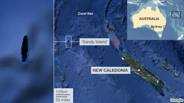
Located in the Pacific Ocean, Sandy Island is one of the most inexplicable spots on earth. Some of the maps can spot this place while some don’t. Google map does not capture this place and discards the presence of this island there in the Pacific Ocean. However, a whaling ship known as Velocity was the first ship to record about Sandy Island. Some people explain the picture of this Island as a photograph of a raft, while others make the story of a mysterious disappearing island.
El Bronx, Colombia:
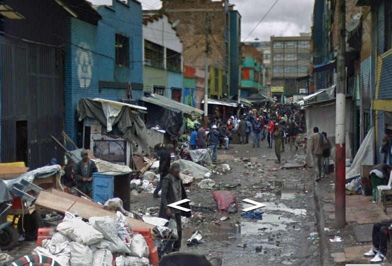
Typically-known as the world’s one of the most crime-riddled provinces, El Bronx is situated in Bogota, the capital city of Colombia. This region does not exist any longer. The Google Street view has only a glimpse of a crowded street in El Bronx. The street you can find on Google Maps has sinister past, as it has witnessed so many murders where the neighborhood was found guilty in murdering and getting involved in child trafficking and the rival gangs used to feed the dead bodies to the starved dogs to spread terror.